Friday, April 28, 2006

Baker Reservoir Campground


We left Zion this morning, stopping to dump and take on fresh water on our way out.

We stopped at the post office in La Verkin to pick up our mail, and then in Hurricane to do laundry.

We ended up at the BLM campground at Baker Reservoir, just east of SR-18 north of St. George, Utah. This is a very nice campground...the sites are far apart, and it is surrounded by mountains and hills.

Miles driven: 66.0
GPS coordinates: N37.3768 / W113.6446

Thursday, April 27, 2006


Today we visited the museum in the park. We learned that there is an arch in the mountains across the valley from the museum...if you didn't know it was there, you probably wouldn't ever notice it. The picture in the museum showed someone standing on the arch...not someplace I'd like to be!

This evening, we had dinner in Springdale at the Pioneer Restaurant.

Wednesday, April 26, 2006

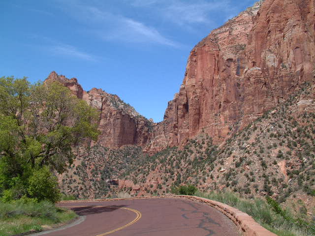
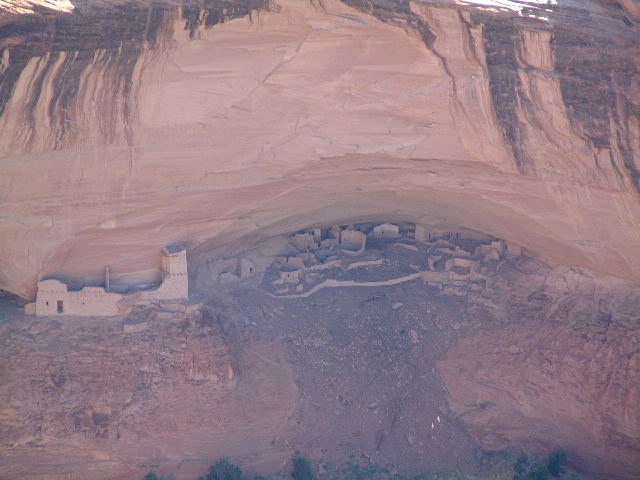
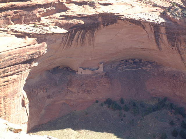
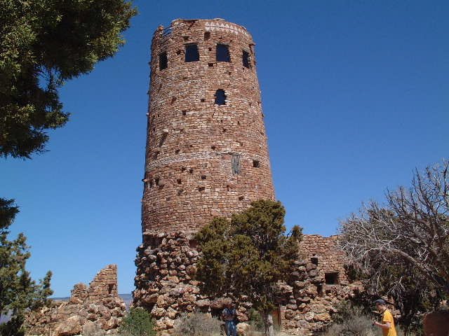
After breakfast, we drove over to the Visitor's Center so we could catch the shuttle (the only way you can see portions of the park).


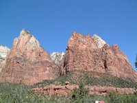
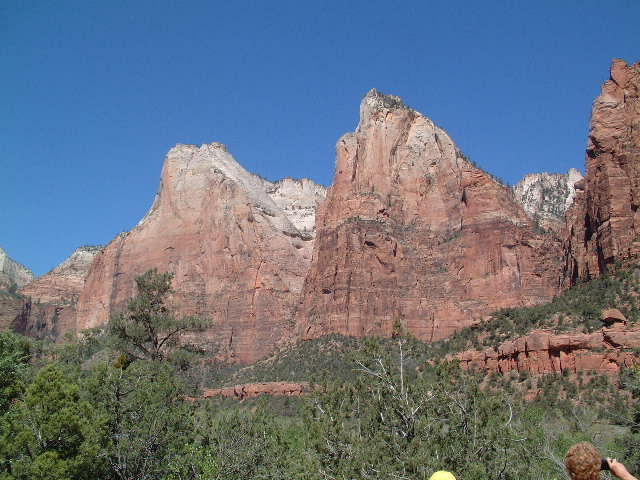
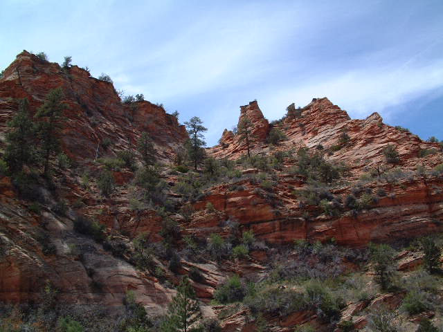
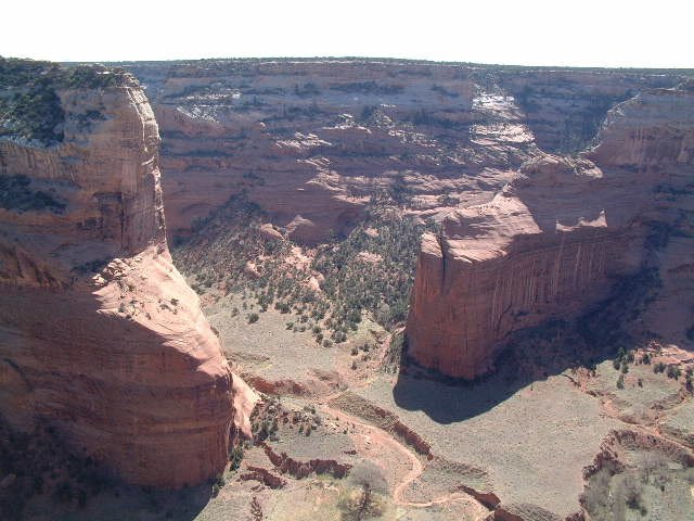
Our first stop was the Court of the Patriarchs Viewpoint, a place we hadn't visited on our trip here in 2003 (which you can read about at http://hometown.aol.com/linda0146/zion.html).


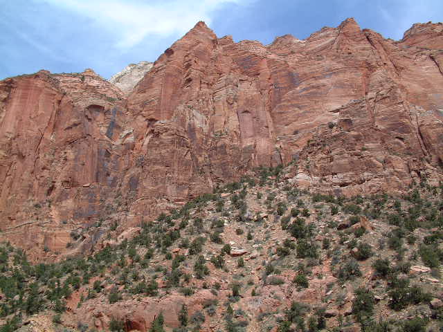
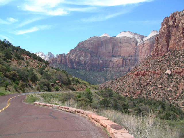
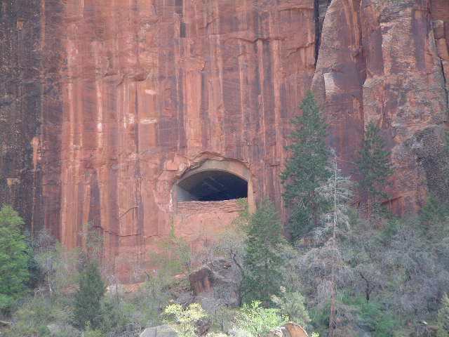
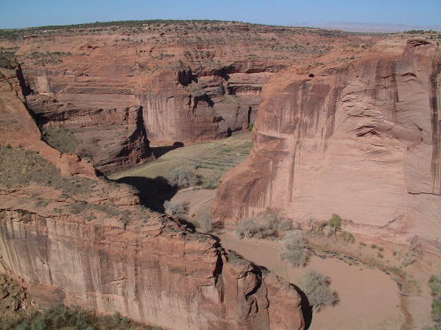
Our next stop was Zion Lodge where we had lunch before getting on another shuttle and riding up to the last stop on the route, Temple of Sinawava. We didn't take the entire Riverside Walk this time, since we'd done it in 2003, so we just walked down to the river this time.


After getting back on the shuttle, we got off at the Big Bend stop because we wanted to watch the rock climbers we'd seen coming up the valley. We had to walk down the road a ways in order to see all of the climbers, so since going back to Big Bend meant walking back up hill, we decided to continue walking down to the next shuttle stop at Weeping Rock.


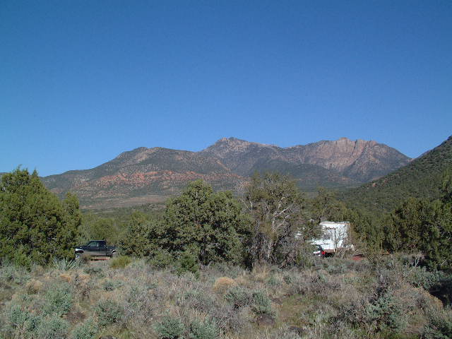
We had a surprise visit by Tioga George, a fulltime RVer well known in the RVing community. He is parked right across the street from us, and is, in fact, the reason we selected the spot we're in, because he has a Datastorm on top of his RV (an automatic satellite Internet system), which was deployed. However, my brain must have been on vacation, because I never put two and two together to realize that it was George who was parked near us. We had a really nice conversation with George, and he put me on to an auto stitch program which stitches several pictures together to make a panorama. I'm looking forward to experimenting with it.

Tuesday, April 25, 2006


We arrived at South Campground around 2:00 PM and set up camp. Fortunately, we're in a spot where we can get the satellite Internet set up (and TV, too). Tomorrow, we'll take the shuttle and do some sight seeing.

Miles driven: 117.4
GPS coordinates: N37.204167 / W112.98295

More Pictures on SR-9


The picture at the lower right is one of the openings in the tunnel...taken from the outside, of course.


Heading into Zion National Park from the east on SR-9 requires passage through two tunnels. The first tunnel we came to was large, so we had no problems navigating through it. The second tunnel, however, is small, and requires that traffic be stopped in both directions so that larger vehicles can travel down the center (current cost is $15, which is good for two trips through the tunnel in a one-week period). This tunnel is a little over one mile in length, and has several opening through which we could see the countryside (of course, we couldn't stop!).

The trip down the other side of the mountain was on a narrow two-lane road, with many switch backs. But there were a few turn offs which allowed us to take pictures of the country side.

Zion National Park


We left Page around 9:30 AM and headed north on US-89, stopping in Kanab, Utah to top of the gas tank in the Lazy Daze ($2.769/gallon). We then stopped in Mt. Carmel Junction for lunch before heading west on SR-9.

The picture above was taken at a pullout alongside US-89, where we'd stopped to stretch our legs and walk Maxx. The road on which Earl and Maxx are walking leads to the Paria Movie Set where some westerns have been filmed.

Monday, April 24, 2006

Page Elks Lodge

We left Chinle around 9:30 AM, stopping first to top of the gas tank in the Lazy Daze ($3.049/gallon).

We decided to drive Navajo Road 59 from Many Farms north of Chinle to US-160 just east of Kayenta. It turned out to be a good two-lane road with spectacular views. The views along US-160 west of Kayenta were also pretty spectacular!

We arrived in Page early in the afternoon and found the Elks Club where we parked (for free with electric hookup). After setting up, we drove the Honda into town to do some grocery shopping.

Miles driven: 166.1

Sunday, April 23, 2006

White House Overlook


White House was named because of the whitewashed walls of the upper level.

This was our last stop, although there are three other overlooks before getting back to the campground. But, it was lunch time, and we were getting hungry and pooped from walking so much!

We didn't take a jeep tour this time, but the next time we come back here, we are definitely taking one. You can use your own vehicle IF you have a true 4-wheel drive, high-clearance vehicle...and, of course, a Native guide (you can't go into the canyons without a guide). Since our Honda Element, while a 4-wheel drive, would not be allowed, so we'll have to go in someone else's vehicle.

Sliding House Overlook


Many of the overlooks have paved pathways to get to the overlook, and, thus, are wheelchair accessible...like Spider Rock Overlook, for example. Others, like Sliding House Overlook do no have paved access, so one must walk to the overlook on native ground. The way is guided by rock cairns and yellow footprints pointing the way.

Sliding House is so named because the dwellings were constructed on steeply sloping ledge, and many of the walls kept slipping.

Face Rock Overlook


There were several ruins to see here; however, most of them were too far away across the other side of the canyon to get good pictures.

Spider Rock Overlook


Today we drove the South Rim Drive in Canyon de Chelly (after first having Blue Corn Pancakes at the Thunderbird Lodge which is next door to the campground). Our first stop was the very last overlook, Spider Rock which is an 800-foot sandstone spire that rises from the canyon floor at the junction of Canyon de Chelly and Monument Canyon. The views were absolutely magnificent...more than one can ever capture in pictures. At the bottom of the canyon was a small farm with horses running loose.

Saturday, April 22, 2006

Massacre Cave Overlook


Our final stop this morning was at Massacre Cave Overlook. Massacre Cave refers to the Navajo killed here in the winter of 1805 by a Spanish military expedition led by Antonio Narbona. About 115 Navajo took shelter on the ledge above the canyon floor and were discovered by Narbona's men. A fight ensued, and shots fired from the rim killed all the people on the ledge (picture at the bottom right).

Mummy Cave Overlook


Our second stop this morning was Mummy Cave Overlook, so named for the mummy found in the ruins.

Mummy Cave Ruin is one of the largest ancient Puebloan villages in Canyon de Chelly, and was occupied from earliest times to about 1300. The east and west alcoves are comprised of living and ceremonial rooms. The tower complex resting on the central ledge was built in the 1280s by people who migrated from Mesa Verde.

Antelope House Overlook


We drove the North Rim Drive this morning, stopping at the three overlooks (there are actually four, but Ledge Ruin Overlook was closed).

Our first stop was Antelope House Overlook which is named for the illustrations of antelope attributed to Navajo artist Dibe Yazhi (Little Sheep) who lived here in the early 1800s. Excavated in the 1970s, this ancient Pueblo village has an unusual circular plaza built in the 12th century. This particular pueblo is built on the floor of Canyon Del Muerto, unlike other pueblos that are built into the cliffs.

Friday, April 21, 2006

Canyon de Chelly National Monument

We left Tuba RV Park shortly after 10:00 AM, stopping to top of the gas tank in the Lazy Daze ($2.989/gallon).

We traveled through the Hopi Reservation on SR-264, but didn't stop. According to a book I am reading by Fran Kosik, Native Roads, The Complete Motoring Guide to the Navajo & Hopi Nations, "Before spending any length of time in any village, permission should be obtained from the village leader" and "It is advisable to check with village community development offices before going into the village..." Of course, "any length of time" isn't defined -- is it one hour? Two? What? And just where, exactly, do we find the "village leader?" It sounded to us like the Hope really don't want outsiders visiting...yet, there are arts and craft places along the highway that appeared to be there for outsiders to visit.

The whole issue of asking permission to stop and visit was very off-putting to us, so we decided just to drive straight through to Cottonwood Campground in Canyon de Chelly (pronounced "shay") National Monument. This is a very nice campground...no hookups, but there is water and a dump available.

We had dinner at Junction Restaurant in Chinle. On the menu, they had several native Navajo dishes...I tried the Mutton Stew and it was excellent! Earl had Chicken Quesedillas, and they were also very good.

Miles driven: 152.6
GPS coordinates: N36.149417 / W109.541467

Thursday, April 20, 2006

Tuba City


After leaving Mather Campground, we stopped at several of the viewpoints on SR-64. Our final stop was at Navajo Point just to the west of Desert View, the location of the Watchtower. (The middle picture is of the San Francisco Peaks as seen from the parking lot.)

The Watchtower was designed and built in 1932 by Mary Colter, an architect for the Fred Harvey Company. She designed and supervised the construction of many of the buildings at Grand Canyon, including Phantom Ranch at the bottom of the canyon. Each stone for the exterior of the building was picked by hand at a local quarry because Ms. Colter wanted each stone naturally shaped.

We arrived at Tuba RV Park (part of the Quality Inn) in Tuba City around 2:00 PM (3:00 PM Navajo time, since the Navajo Reservation goes on Daylight Savings Time even though the rest of Arizona does not). After dinner, we drove down to the Basha's to pick up a few groceries.

Miles driven: 84.4
GPS Coordinates: N36.13088 / W111.24223

Wednesday, April 19, 2006

Grand Canyon National Park

Our first stop after leaving the RV park, was to stop by the Chevron station to top of the tank in the Lazy Daze. Yesterday when we drove in, the price at the station was $3.059 per gallon...today it was $3.229! We did have a coupon from the RV park for a savings of $.20 per gallon, making the price we paid $3.029 per gallon. Just wished we'd filled up yesterday!


After arriving at Mather Campground inside the Park, we walked up to the shuttle station, and rode to Yavapai Point. From there, we walked .75 mile to Shrine of the Ages where we were going to catch the shuttle to the Red Line that would take us out to Hermits Rest. We decided, however, just to walk back to the campground...which was probably another .75 miles.

The information I had on Mather Campground was that reservations were necessary anytime after March. Since we rarely make reservations when we travel, I wasn't sure we'd be able to get a spot, but we had no problems...which we find is usually the case if we stop early in the day.

If you look closely at this image (you'll probably have to click on it to see the larger picture), you'll see part of the Bright Angel Trail which goes down to Phantom Ranch at the bottom of the canyon, a trip of 7.8 miles and a descent of some 4,458 feet!


Miles driven: 62.3
GPS Coordinates: N36.04817 / W112.12008

Tuesday, April 18, 2006

Canyon Gateway RV Park

We left the SKP park about 10:00 AM and headed north on US-89 to Prescott. There is a sign on US-89 before starting up the hill when leaving Congress that no vehicle longer than 40' is allowed past a certain point. The road is through the mountains and has many hairpin turns which a larger rig would find difficult to negotiate without going into the oncoming lane.

We stopped in Prescott to do some shopping...first at the Petco to pick up food for Maxx, and then at Costco. After shopping at Costco, we had lunch in the rig before taking off.

Our original plan was to spend the night at the Coconino County Park at Cataract Lake just west of Williams, since the information we had was that it was open all year. However, when we got there, we found it does not open until May 1, and there was a gate across the road. Likewise, the Forest Service Campground at Cataract Lake was also closed until sometime in May. Fortunately, we do have a Passport America park in Williams, so we were able to stay at Canyon Gateway RV Park for half-price ($15.54 with tax...a bit more than the $6 we would have paid at the county park!).

Since we hadn't thought to take anything out of the freezer to thaw for dinner, we decided to go out (you don't have to twist our arms!). We ended up at Bella Donna restaurant where we had some excellent Italian food. We'll definitely go back the next time we're in Williams.

After dinner, we stopped by the Safeway store to pick up a few items that we figured would be hard to find once we got on the Reservations (Hopi and Navajo) later on this week.

Miles driven: 126.1
GPS Coordinates: N35.26462 / W112.19147

Monday, April 17, 2006

North Ranch RV Park

We left Quartzsite a little after 11:00 AM, stopping at the Chevron to fill up the Lazy Daze (gas at $2.799 per gallon!).

We drove east on I-10 to the US-60 cutoff, and headed north through the little towns of Brenda, Hope, Salome, and others, stopping at a road side pulloff shortly after noon to have lunch. Stopped at the Safeway store in Wickenburg to pick up a few items, and then headed to the Escapees' park just south of Congress on SR-89. We're in the dry camping area...$2.66 including tax.

Miles driven: 99.3
GPS Coordinates: N34.10455 / W112.82972